Geospatial data is vital infrastructure for our country, but we’ve made some mistakes in the past. Let’s stop the UK’s underground data going the same way.
Geospatial data about places and things helps us get the services we need. It helps get parcels delivered to the right house, helps us know who we can vote for, and helps government plan where to build new houses and roads.
Geospatial data carries less risk of harm than more personal data, and can create large benefits.
But to create these benefits the data needs to be available to and used by people who need it, and that’s where the UK has made mistakes.
The government is currently consulting on the operating model for a new National Underground Asset Register – a list of things like underground pipes and cables.
If we repeat the mistakes of the past and build a model that makes the data too expensive to use, too hard to use, or too limited in what it can be used for then the potential benefits won’t happen.
Let’s do things differently this time.
There have been mistakes in the past
Successive UK governments have let geospatial data slip into a complex and costly tangle of intellectual property rights and contracts managed by private companies and public sector bodies. This tangle makes it hard to access and use data, and puts a brake on the potential value that geospatial data could help create.
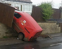
The most famous, or infamous, example is address data. Countries from France to Australia to Denmark offer official, freely available address data, but the UK has instead encouraged the Ordnance Survey and Royal Mail to make profits by restricting how it can be used.
This causes problems like people struggling to register for a doctor or get a credit card. It even made it more difficult to determine who needed to shield during the pandemic.
One person who told us their address story said:

The model for the National Underground Asset Register should be debated
The UK government’s Geospatial Commission is now consulting on a National Underground Asset Register (NUAR) for England, Northern Ireland and Wales. NUAR will provide all underground asset data – data about things like water and gas pipes – in one place, and a map of the underground assets in a particular location. It is due to be built by 2024.
NUAR is initially intended to be used to help reduce the number of times that underground assets are accidentally damaged, but new uses for the data, platform and map could be found in the future – perhaps underground data will help people design new networks for the new forms of renewable energy, help developers plan houses, or people decide which house to buy.
Lots of great work has gone into NUAR so far, but it is important that as NUAR is built the mistakes that have happened with other types of geospatial data, like addresses, are avoided.
If we repeat the mistakes and make the data too expensive to use, too hard to use, or too limited in what it can be used for then the potential benefits won’t happen.
The technology, governance and funding model need to be scrutinised and debated.
That is how we will get the best outcomes both now, and for the future.
What now
As part of that debate we are asking the Geospatial Commission to consider an open, digital approach to NUAR and to avoid the mistakes of the past. Here’s how you can too.
You can respond to the Geospatial Commission’s consultation online by Thursday 2nd June 2022.
You can also read our longer briefing and, if you want to, you can use as much of our response as you like in your own submission.
Please share this information with anyone who might be interested.